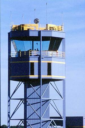
Adelaide TowerInformation provided by Airservices AustraliaAdelaide Tower stands 21 metres high and was built in 1981. Airservices Australia has implemented a National Towers Program which in its first stage will see the replacement of tower facilities at Adelaide, Rockhampton and Melbourne. Airservices operates 26 control towers across Australia, many of which were constructed between1941 and 1995. A number of these have now exceeded their design life, contain obsolete equipment no longer supported by suppliers and require modernisation to bring them in line with current industry standards. Related projects under the National Towers Program involve the refurbishment of a number of other ageing tower facilities and the incorporation of new tower technology into the refurbished and renewed buildings. The project aims to introduce a blueprint for a nation-wide program centred on a standardised approach to tower construction and fit out. This includes reducing the range of tower building configurations by using a modular approach to building design. The new towers will be designed with a minimum building lifespan of 20 years. The project will also deliver tower Infrastructure. Tower controllers operate Surface Movement control on 121.7, Airways Clearance delivery/Co-ordinator (ADC) on 126.1 and Tower on 120.5.
|
Adelaide Control Tower
21 Metres High Built 1981 |
||||
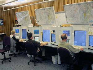
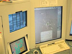
| Adelaide Terminal Control UnitTCU operators are responsible for controlling air space in the vacinity of the airfield from a short time after the aircrat leaves the ground until 36 nautical miles from the field.
TCU operators are also responsible for inbound traffic untill 5-10 nautical miles from the airfield where aircraft are handed over to Adelaide Tower. Below is an overview and facts about the Adelaide TCU. Facts and Figures provided by Airservices Australia. |
TCUs – Terminal Control Unit Stations | ||||
|
Adelaide Terminal Control Unit: Facts and Figures The Adelaide TCU operates 24/7 and is staffed by an experienced team of air traffic controllers.
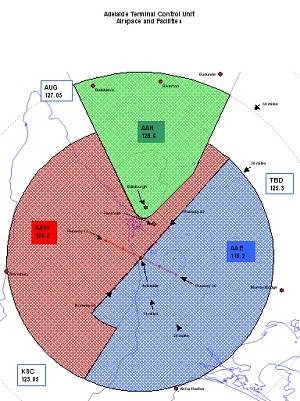
Geographically, the airspace extends to Stansbury in the west, Victor Harbor in the south, Murray Bridge in the east, and Balaklava / Riverton / Eudunda in the north.
Control Areas ApproachWest (AAW) on 124.2 MHz controls traffic to the west of the extended runway 05/23 centreline. Approach East (AAE) on 118.2 MHz controls traffic to the east of the extended runway 05/23 centreline. “East” also has frequency 130.45 MHz which is used for light aircraft traffic in class G (uncontrolled) low level airspace. Approach North (AAN) on 128.6 MHz controls traffic in the wedge of airspace to the north, which tapers to about a 4 mile radius to the south of Edinburgh. “North” also has a UHF 306.3 MHz which is used for some military operations. “North” is often combined with “West” when there is no military traffic. During quiet times of civilian traffic, “East” may also be combined so that all services are provided from one console.
Non-Regular Traffic Apart from regular transport traffic, there are medical and police helicopter movements to deal with, media helicopters, photographic and survey operations in helicopter and fixed wing aircraft, RFDS operations, corporate jets, joy flights, parachuting operations, and in the warmer months, shark patrol and bushfire water bomber operations. In addition, Adelaide Approach also provides services to numerous training and general aviation aircraft travelling to and from Parafield Airport, and to military aircraft operating from Edinburgh, many of which fly over or conduct operations at Adelaide Airport in the course of their operations. Special events such as air shows or aviation activity associated with events like the Clipsal 500 motor race and Tour Down Under add to the traffic mix. An interesting mix prevails of fast and slow, rotary and fixed wing, large and small aircraft.
Related information: How Air Traffic Control Works (view)
|
|||||
| Credits5DME would like to thank all the staff from Airservices Australia who contributed to the information above.
Photos are courtesy of Rod Brown. ATCU Map Courtesy of David Smith. Additional Airservices photos are available in our Photo Gallery. |
|||||
